Newport To Maine
Newport to Maine
It was and early, at sunrise, start for the sail to Onset in Buzzard Bay at the mouth of the Cape Cod Canal, the largest single water level (no locks), about 10 miles long with a 4 foot tide at one end and 9 foot at the other, making for interesting current flows!.
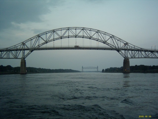
Sasha checked the currents and tides on both the PC and the Waterway guide to determine that a 6am start would be best. We had to go with the exceptionally strong current, the Canal Patrol will not even let sail boats enter against the tide. At 6am were heading into the canal proper but were stopped by the Canal Patrol as the railway bridge was down and we had to turn around against the current. I had Ednbal at 2200 rpm just to keep from going backwards. Once into the canal we were doing 11.4kn SOG (speed over ground) – I am sure the fastest Ednbal had ever been. In a little over 50minutes were out the other end and into Cape Cod Bay heading to our next top Provincetown on the northern end of the Cape itself. Now we were in tidal areas where one must be conscious of the 9 to 10ft (3 metre) tide when selecting an anchorage. We tied to Provincetown Marina’s fuel dock to refuel and filled water tanks at their floating dock (jetty), an interesting experience as the attendant was on the fixed dock some 12 ft above us with the end of the fuel hoses down on the floating dock. Red for gas (petrol) and green for diesel, no water. There were no steps from the floating dock up to the fixed so the transaction was via voice and a bucket. When ready to take on fuel, yell to the attendant to turn it on then put the credit card in the bucket that he lowered down on a rope. The credit card receipt to sign came back down in the bucket and the transaction was complete. Water, we were told, was available at the town courtesy dock on the other side of the fueling dock, check with the harbour master on VHF channel 12. The harbour master directed us to a tiny fixed dock right up against the sea wall, there was no chance of getting Ednbal to it! Being a little unsure of anchoring in tidal areas and being unable to see anyone on anch or we elected to “hire” a mooring for our stay of 2 days but soon got a shock to find it available from Provincetown Marina at $45 per night but water was available at one of their docks. Surprisingly the person organizing moorings was also the harbour master! We stayed one night on the mooring, being rocked around all over the place by passing whale watch ferries, and anchored the next!
Ashore in Provincetown had a very definite fishing village flavour mixed with art and a very noticeable gay population. At the fresh seafood market we bought another lobster, $9 per lb, but found the texture to be much the same as the one at Newport, unlikely to buy more lobster.
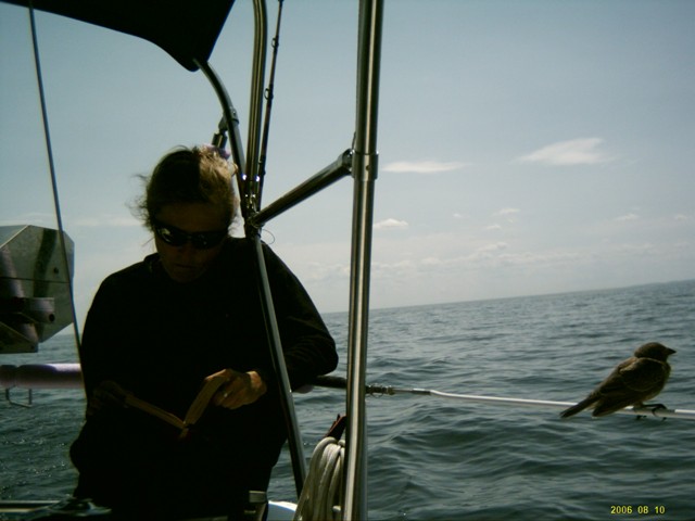
It was a day sail North West across Cape Cod Bay and the Northern Right Whale critical habitat to the fishing village of Gloster, north of Boston. A truly memorable day. Started with 18 knots abeam sailing at 7kn, saw the whale watch ferries go past and on a beautiful day with the sun out and clear skies saw many Northern Right whales. One surface less than 10 yards (metres) form us, causing quite a scare as they are huge mammals, bigger that Ednbal. A while later Sasha was sitting on the stern perch reading when a small brown land bird landed on the safety line less than a metre away from her and stayed there for 10 minutes or so, perhaps just resting. After a 12 hour trip we were on Gloster’s inner habour, anchored in a very small area with 4 other yachts (sail boats) next to the channel used by the fishing vessels.
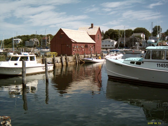
Gloster was the first real fishing village we visited, almost no tourists, no main or front street flogging all manner of junk but a real quiet, hilly, green fishing based village. There were lobster traps everywhere. The construction is somewhat different to the West Australian crayfish pot. The Lobster trap is made from plastic coated wire mesh, about 25mm (1”) square with the 6 sides held together by stainless steel clips about every 100mm (4”) apart. The trap is about 1200mm (4’) long by 600mm (2’) or so wide and deep. Lobster entry points are on the side as against the top on a crayfish pot and there seems to be only one small escape hatch at the end. Most seem to have small steel weights but some had house bricks in specially made housings each bottom corner of the trap. When set in the water there is a cylindrical float about 200mm (8”) diameter and 600mm (2”) long with a short pole about 600mm by 25mm poking out the top. The rope down from the bottom has a weight a couple of metres down so that, as distinct from the crayfish floats, there is no floating ropes. Although floats for different traps may be only a few metres apart you can generally have the float even touch the side of the hull without fear of getting the rope caught under the vessel. When setting traps, it seems common to have one float and several traps tied together in a line, 4 or 5 metres apart with another float at the other end. Not only were there thousands of pots in the water but also large numbers stacked up at various places ashore. Lobster fishing appears to be done by many small vessels, 20 to 40 ft, compared to the 60 to 80 ft crayfish boats typically seen off Fremantle. Luckily the Gloster anchorage was in a 5kn “no wake” zone so we were not disturbed too much by the pre dawn exodus of lobster boats heading out to retrieve their catch.
While in Gloster we installed the much awaited aft cabin shelf to store books and other items that had been taking up space in saloon cupboards. Atfer measuring 10 or 20 times, I managed to get the shelf material cut reasonably correct and the fit was reasonably successful!
Gloster is also the fishing village home of the Andrea Gail out of the book and movie Perfect Storm so we just had to go and have a couple of beers at the Crows Nest hotel, watering hole of fishermen crew of the Andrea Gail. Here we meet a old fisherman with long thick wirery white beard and hair. He was none too happy with the Andrea Gail photos on the wall of the old pub saying that he too had lost friends fishing and that it was wrong for one boat to be imortalised.
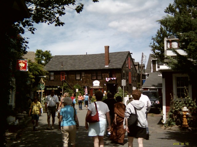
Next day, Friday it was a 5am start fo an 80 mile sail to Portland, mostly in a North, North East direction. As forecast a 15 to 20kn Nor Wester was blowing that I thought would give us a good sail. After rounding Cape Ann and settling onto the course for Portland it soon became apparent that it was not so comfortable with the wind and sea just off the port bow. We decided ther was no need to have uncomfortable travel so changed course for Rockport on the northern side of Cape Ann. Rockport was another fishing village but with a reputation of being home to many artists and having a main street featuring art galleries displaying local art.
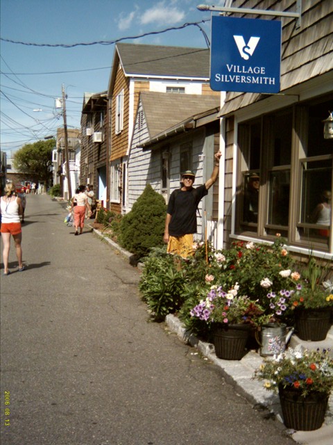
There was no roon to anchor in the small port so we dropped the pick in Sandy Bay, open to the ocean, around the point to the west of the harbour. Although a beautiful outlook, huge granite stone wall with houses atop on one side, small beaches amongst granite outcrops on anther and then the open ocean, it was rather rocky and rolly side on to the short swells. With the dingy, tadpole, bashing up against the stern of Ednbal it was very tricking getting the 45kg outboard off its pulpit mounted bracket and on to the dingy. Ashore, via the Sandy Bay Yacht Club floating dingy dock, we indeed found a thriving artist colony. Paintings and all manner of handcrafted items were in a wide variety of galleries and shops. We ate lunch, a couple of beers and sandwiches that Sasha had made, sitting on the granite rocks that form the groin breakwater entry to the small harbour. In the sun it was quite warm. After a good walk around Rockport it was back to Ednbal with fresh fruit and vegetables purchased at the local market. Since we had stocked up on perishables while we had the hire car at Atlantic Highlands, all we needed were the non perishables. After a fairly uncomfortable night on a rocky rolly Ednbal, the following day, Saturday, was spent lazing around and as the light breeze was still nor-west we decide to wait another day for the forecast 10 to 15kn sou-wester forecast for Sunday.
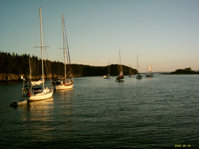
With the breeze as forecast we set sail very early Sunday morning for the 70 or so mile run to Jewel Island just a few miles north of Portaland Maine and near the mouth of Penebscot Bay. Yes we would finally get to the waters of Maine and all the natural beauty we had heard so much about. After a lovely days sail, catching another 4 -5kg bluefish on a skirted lure while under full sail, we arrived at Jewel Island to join another 5 yachts lined up in the narrow, about 80m wide by 500m long bay on the western side of Jewel Is. The Island itself was only a few Km long and a couple wide with the highest point some 100m. Again a granite island that we soon learnt was typical of the islands of Maine. The waterway guide mentioned walk trails and abandoned World War II tunnels on this uninhabited Island that sounded quite interesting. So, it was fresh fish frame on the bbq with Sasha’s potato bake for dinner and a good nights sleep ready for Island exploration the next day.
On shore we meet a New Zealand family who were sailing a 50 year old wooden ketch they had bought on Ebay, from Newport and had been sailing from there for the last 4 months. They would soon be heading south to Florida where the vessel was to be shipped back to New Zealand. After a short chat and picking up the scoop on the walk trails we set off. It took only ¾ of an hour to get to the tunnels that turned out to be a labyrinth of concrete hallways and rooms with two large 4 storey high lookout towers adjacent. We stood atop of the towers for some time just gazing out at the 360 degree view over the ocean and Island.
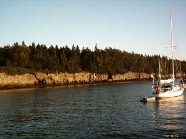
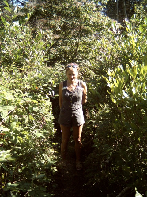
Back on the ground, walk trails led through lush green forest over a bed of fine leaves and moss that was soft yet firm under foot. Certainly the best walk trails I had seen. I think, on the way back to the dingy, that had been tied to the base of a tree at the high water mark to allow for the 10ft tide, we saw most of the island’s walk trails, not quite intentionally!!
The following morning bought some very dim Maine weather. Rain then thick fog, we could see only the 2 closest vessel, and cold. Although still 18C the chill factor of the breeze over 11C water was significant. The fog did not lift until midday so we decided to have a lazy day on board before the shorter 40 mile sail to Mohegan Island the next day. As it had been on the way to Jewel Is the trip to Mohegan was very much a case of lobster float dodge-em for most of the trip. Thankfully it was a beautiful clear day as the high pressure system came in after the cold front but still a bit chilly and no wind at all causing us to motor all the way. Mohegan Is was a combination fishing village, summer artist retreat and local “get away from it all” holiday destination. Mohegan was somewhat larger than Jewel Is with a map of walk tails, no sealed roads and only a few vehicles to travel on the 1 or 2km of dirt road. The Waterway Guide did not recommend anchoring as the bottom had poor holding so we hooked onto one of the mooring buoys in the harbour, a separation of Mohegan and the much small uninhabited Horn Island.
As we had arrived early, before lunch, (we had made good time, averaging nearly 7kn SOG running with the current) we had the pick of the moorings which were soon taken up by others arriving during the Wednesday afternoon. Amongst them was a friendly bunch on a 47ft sloop, Passage, registered in Chicago, who invited us over for a beer later in the afternoon. We rowed the dingy to the nearby shore for a short walk around and bought 2kg of fresh mussels at the seafood market for Sasha to make chili mussels to take and eat with the beers. Mark, Sandy, Dick and Jean had bought their 24 year old vessel, in Maine, from the original owner, only a few months before and had, coincidently, run into the original owner on shore that afternoon. The teak work below decks was something to behold! We had beer, champagne, chili mussels followed by pasta and Maine shrimp cooked by Sandy in the broth from the chili mussels. After too much to eat and drink we rowed back to Ednbal and hit the cot.
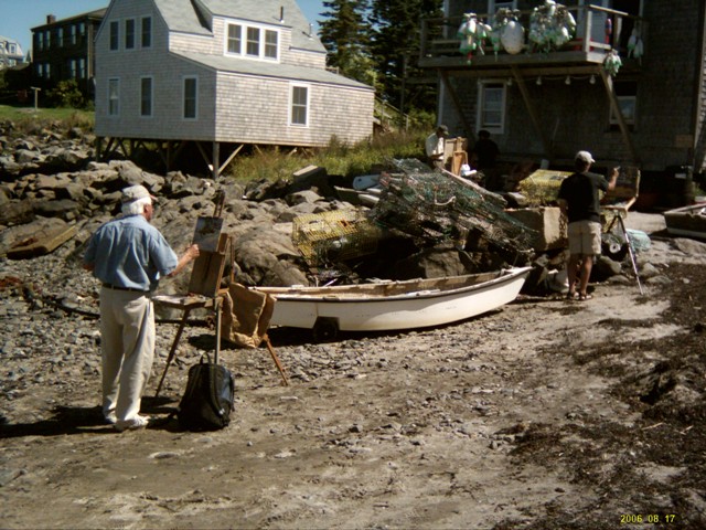
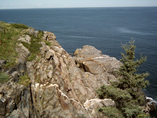
By the end of the next day we had covered the longest walk trail that circumnavigates the island. In many places the trails were similar to Jewel Island but with numerous excisions to high granite cliffs overlooking the ocean. At various points, many artists sat or stood at easels painting scenes, objects and colourful flora that was Mohegan Island.
After a night of heavy due I was able to give Ednbal a good wipe down without wasting fresh water before we set off for Tenants Harbour en-route to a group of Islands on the Western side of Penobscot Bay. Once more it was dodge the lobster float, especially coming into Tenants Harbour with hundred upon hundreds covering the harbour entrance. The Waterway Guide mentioned only one refueling outlet, Cod End Market so the first pier we saw with a fuel pump on it we went into to be politely told we could not buy fuel there and to go further down the harbour. Further down we found Cod End Market with a small floating dock and a very long (50 metres or so) fuel line up to the fixed dock fuel pump. We refueled, rewatered and were able to leave Ednbal at the fuel dock while we went to the nearby Halls Market to stock up again on fresh fruit, veg a few other items that were running low. Two hours later we were eating lunch anchored between Dix, High and Birch Island. Again an abundance of lobster pots that mad finding a space to anchor, with enough swing room, rather a challenge.